Welcome to Dalaborg, an important site in Sweden's history
Dalaborg was constructed in connection with conflicts between the sons of King Magnus Ladulås, namely Birger, Erik and Valdemar. The latter two planned a western Nordic kingdom with fortresses around southern Lake Vänern, with Lödöse as a capital city. The Chronicle of Duke Erik (Erikskrönikan) recounts that the peasants were forced to work night and day on construction of the fortress. Already the same year, King Birger attacked Dalaborg and a peace treaty was signed. In 1308, Norwegian forces lay siege to the fortress, but without success.
Towards the end of the 1300s, the fortress was managed by one of the most important men in the country, Lord High Constable Erik Kettilsson Puke. He supported the assurance of loyalty sworn by the twelve Swedish grand nobles to Queen Margareta of Denmark and Norway which took place on 22 March 1388 and resulted in Margareta also becoming Queen of Sweden.
Discontent with, among other things, the exercise of power by the Danish sheriffs in Sweden during the reign of King Erik of Pomerania, led to the Engelbrekt rebellion and Dalaborg was torched and razed to the ground in 1434. The sheriff at the time was called Palle Joansson, who was Danish. The fortress was never rebuilt and, as happened at the sites of many other fortresses in Sweden, inhabitants of the surrounding district took stones and other building materials from the ruins. Dalsland had no other fortresses in the Middle Ages apart from Dalaborg; on the other hand, fortified settlements are known.
Remains of a brickworks are found to the right of the pathway that leads from the fortress ruins. The brickworks are noted on a map from 1781, but it uncertain when they were constructed.
The site was investigated in the 1930s and, further out on the promontory, there are several signs that describe the fortress and the place it occupies in the landscape of Lake Vänern.
The terrain as defence
When a defensive structure was constructed, the terrain was used to make it as difficult as possible for potential assailants to attack. Fortresses were often constructed on natural high ground since it is easy to shoot down on the attacker, while the latter must attack upwards. Naturally steep slopes, water or wetlands were used to restrict where and how the attacker might approach the fortress. In the absence of natural high points or obstacles, they could be constructed using manpower, but this was a time-consuming and expensive process and so the landscape was exploited as much as possible to facilitate the construction.
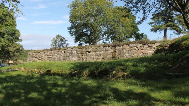
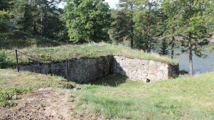
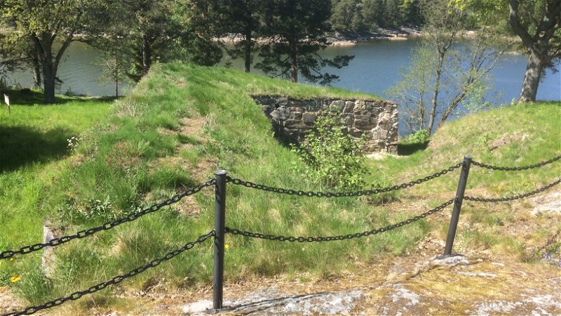
Dalaborg lay with three sides facing Lake Vänern on the Slottskullen promontory. The promontory is separated from the mainland by the ravine where you are now standing. The ravine forms a natural moat which is easy to defend from the plateau above; traces of a rampart have also been found here. According to archaeological excavations, the way up to the fortress went through the moat and was paved. Thus, an assailant was forced to move along the plateau, where the defenders could shower stones down on them or shoot them using a crossbow, bow and arrow or early hand cannons. Since the fortress was built on the rock, it was also not possible for an assailant to tunnel his way in, something that was common in the case of long sieges. The winding path and the hilly terrain make it difficult to bring large-scale siege equipment, such as battering rams, to the fortress. The landscape around the fortress was certainly cleared of trees and undergrowth in order to provide the fortress’ defenders with an unconstricted field of fire and the possibility to see the attackers from afar.
The blockhouse
During the 1930s, an archaeological investigation was undertaken of the fortress, as well as a restoration of the ruin. The investigation revealed clear signs of fire in the ground, demonstrating that the siege of the fortress in 1434 was violent.
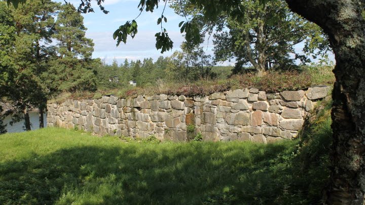
The main building may have been what is referred to as a blockhouse, comprising a walled lower floor with a peat-roofed timber superstructure. The building was constructed in part to exploit the rock as a foundation, and thus walls only needed to be constructed facing north and west. The walls bore traces of mortar, which indicates that they were plastered. A series of beam holes in the wall probably constitutes traces of the fixing points of the timber superstructure. There may have been a shooting gallery along the sides of the fortress, from which the defenders could use crossbows to shoot the attackers or, as the Karl Chronicle (Karlskrönikan) describes the destruction of the fortress in 1434, they could have used guns, probably early hand cannons.
The courtyard was enclosed by ramparts on three sides and, to the east, was limited by a stone clad rampart in front of the facade of the fortress. A thick layer of blue clay was found between the rampart and the facade. One theory is that this was to prevent assailants, since the area with clay could be saturated and made extremely slippery, thereby making it difficult to approach the wall.
During the excavations of the 1930s, among other things arrowheads, spurs, counters, various tools and fragments from Rhineland stoneware jugs were found. In 1994, the ruins were restored and new wall cappings put in place.
Vänern - The world
Dalaborg enjoyed a strategic location by Lake Vänern with communications to the rest of West Sweden. Qvantenburg lies to the south-west of the fortress ruin; this was originally a supply farm for Dalaborg. Southwards at Dalbergs there was a marketplace with Lake Vänern’s best natural harbour, which is mentioned in written sources for the first time in 1508. At the marketplace, Karl IX decided to establish a city to control trade and counteract border trade with Norway, but the plans were never realised; on the other hand, the construction of a royal estate was begun.
Lake Vänern posed not only an obstacle to assailants; the lake also gave the possibility for communication with the rest of West Sweden. The water around the promontory is too shallow for boats except at one place, by the northern side of the wall. Here, there would have been steps down to the lake and a jetty to facilitate transportation on Lake Vänern. Immediately to the east lies the Hindens rev peninsula and the Jarlehus ruin on Kållandsö, where the Läckö fortress was also situated. The fortresses of Aranäs and Amneholm by the Gullspång River were also located on the eastern coast of Lake Vänern. The fortresses of Edsholm and Saxholmen in Värmland were located to the north. During the second half of the 1300s, Erik Kettilsson Puke was not only the master of Dalaborg but also of Amneholm and Edsholm. This made Lake Vänern into his “Mediterranean”, his own lake which facilitated transportation and also the control of trade and taxation.
Trade from northern Värmland went through the Klar River and across Lake Vänern, southwards to the Göta River and Lödöse. Lurö lies in the middle of the lake and can function as a site for transshipment of goods. During the winter when the lake was frozen, it was easier to journey across it than on the winding sunken lanes on land. The ice routes were marked with branches and were trafficked with sleighs. In troubled times, the branches could be moved to lead enemies out onto thin ice. The ice routes were passed down from father to son in order to make it difficult for outsiders to travel on unmarked routes.
One of the few legends about Dalaborg tells that once upon a time a queen who was very cruel to her subjects lived by the mouth of the Dalberg River. Therefore, the subjects swore an oath and placed the queen in a carriage drawn by six horses, and drove her off the mountain. There, even today, the carriage can be seen at low tide. And, on the outermost ledge of the cliff, a pair of parallel cracks resembling wheel tracks, can be seen.


